For five or six years I've wanted to have a go at a bikepacking route called the Cairngorms Loop. Confusingly it actually consists of two loops, one inside the other and to complete both loops is a fairly strenuous undertaking. I knew I didn't have the time (and possibly the legs or willpower) to complete both loops so I asked for advice as to which parts would provide the best riding for a three day trip on the Bearbones Bikepacking forum. The recommendations were strongly in favour of the outer loop which is longer but has more rideable terrain. A few people reckoned that a variation of the classic Tour of the Cairngorms (on which the Cairngorms outer loop was based) would be the best option and so I decided to go for that. The weather forecast for the three days that I had available was for days one and two to be settled and fair but there was potential for rain on the final day so I decided to try to get the bulk of the 122 mile distance covered on days one and two, leaving a shorter third day in case the weather was bad.
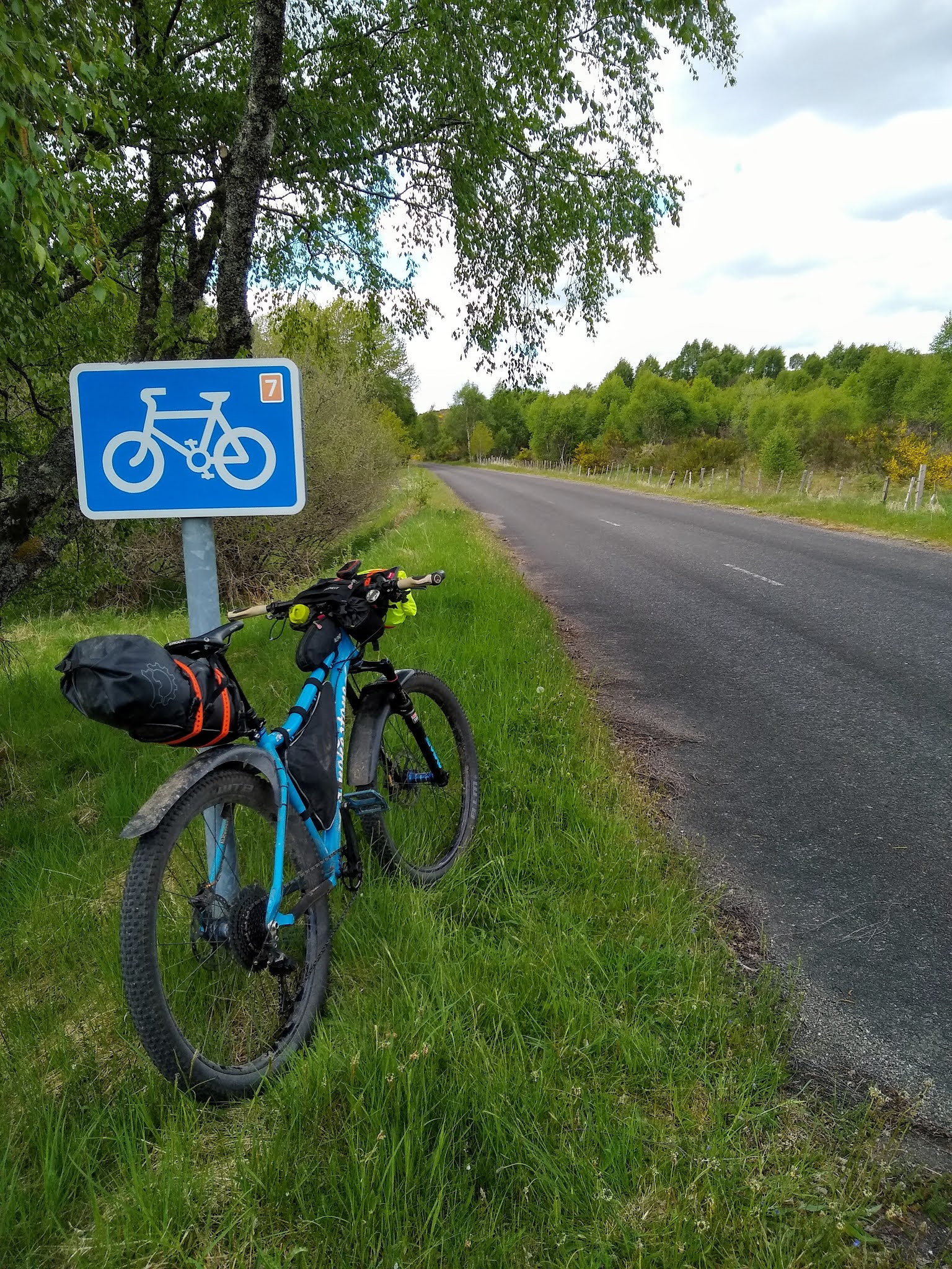
With my planning and preparation completed I set off to drive to my starting point at Blair Atholl at lunchtime and after a couple of hours driving (including negotiating roadworks on the A9 near Perth) I set off on my bike at about 3:30pm. The first section followed NCN 7 (cycle route) on a minor road and then cycle path running parallel with the A9.
It wasn't a bad ride for the most part, the road section being far enough away from the busy A9 to reduce traffic noise and the cycle path wasn't very far. I made good time anyway and had soon covered the ten miles to Dalnacardoch Lodge where I turned off onto an estate track towards the dilapidated Sronphadruig Lodge.
The estate track ends just after the lodge and I had a brief section of hike a bike through some peat hags before joining a singletrack trail that ran alongside Loch an Duin. This was quite good fun with the possibility of a mistake leading to rolling down the banking towards the loch spicing things up!
Once I reached the other end of Loch an Duin I was able to cross the Allt Loch an Duin river at the normal fording point rather than having to walk back upstream to the outflow of the loch as had been suggested as necessary during wet periods by my advisors on the forum. Apparently the river can get dangerously deep and fast flowing after heavy rain and was the first of several potentially dodgy river crossings on the route. Thankfully I was riding after a dry spell though. Once across the river I joined another estate track leading down towards Loch Bhrodainn, Gaick Lodge and Loch an t-Seilich.
Beyond Gaick Lodge the track improved again and eventually became tarmac surfaced as I got down into Glen Tromie. At Tromie Bridge I turned off onto a forest road that would lead me over towards Glen Feshie where I joined another section of tarmac. Glen Feshie was a treat with beautiful scenery and varied riding on dual and singletrack trails.
At Feshie Bridge I popped out briefly onto a tarmac road, crossing the river before plunging back into the forest again heading towards Loch an Eilein and Inshriach.
The daylight was beginning to fade as I rode past Loch an Eilein but I knew it wouldn't go properly dark for quite a while so was happy pushing on towards Rothiemurchus forest.
It was strange riding into the familiar territory of Rothiemurchus, I've cycled a fair bit in this area while we've stayed at Glenmore in the camper van. Once I reached the Cairngorm Club footbridge I started looking for a place to stay, I was still feeling okay and it was still light and I could have pushed on but I hoped to get breakfast the following morning at a café at Glenmore so I decided to camp next to a burn just before the bottom of the Lairig Ghru. There were a few midgies out but not many and I was able to get by without resorting to my midgie net by walking up and down as I ate my dinner sandwich. After that I got in my bivvy bag (which has a built in midge net) under my shelter and dozed off for the night.
I got up just before 7am and combined packing up with making my porridge and coffee for breakfast and was ready to roll by 8:30am. I knew the route well from here to Glenmore and only stopped to take a photo at Loch Morlich.
I arrived at the Pinemarten café looking forward to having a cooked breakfast and a cup of tea with milk but was disappointed to find it closed until lunchtime. No matter I thought the NTS café across the road would be open. Wrong again, although there were signs of life there it wasn't open yet and I wasn't prepared to wait around. Although I was disappointed to miss out on my second breakfast I was more annoyed that I could have pushed on further the night before if I'd known. I pedalled on up past Glenmore Lodge towards the Green Lochain and Ryvoan where I stopped for the obligatory photos.
The descent from Ryvoan pass to Abernethy was new territory for me and it was nice to see that the forest was comprised mostly of mature Scots Pine trees like Rothiemurchus rather than commercial forestry as I'd half expected. The scenery was stunning with some sections of meandering singletrack through the forest as I progressed through the Braes of Abernethy.
After a brief spell on the road up to Dorback Lodge I began the climb up to the bealach between there and Glen Brown on decent doubletrack. It was a fair climb but the gradient wasn't too severe so I was able to ride all the way to the top.
The descent into Glen Brown was fast and loose so it didn't take me long to reach the bottom. Glen Brown was another section that I'd been warned about if the river was high as it has multiple crossings. Again the water level was very low and I was able to ride most of the fords.
It was a relief to reach the other end with relative ease as I'd built this section up as a difficult bit in my mind but I was soon climbing back out the glen before dropping back down to join the A939 to Tomintoul. I stopped in the town square in Tomintoul and bought a small feast from the post office before having a picnic sitting on one of the benches in the square. Stuffed to the gunwales I wobbled out the other end of town and began to follow the river Avon upstream on a well surfaced estate road.
Eventually the road turned into a track and began to climb steadily but it was still good going as far as the junction with Glen Builg. After that it deteriorated into mostly rideable singletrack running alongside Loch Builg.
After Loch Builg I turned off again on track leading to the Bealach Dearg. This climb was tough going and I ended up walking some of it. It's interesting to reflect on the physical and mental highs and lows of a ride and this was my low point on this one. Maybe I'd eaten too much in Tomintoul and my body was struggling to digest it but I felt like my legs had no power and I just couldn't be bothered trying to ride a section that (whilst being a big climb) I'm sure I would have ridden more of on another day. Towards the top I regained my willpower and leg power and remounted to ride the final section. The top is around 730m high and has spectacular views of the surrounding mountains with the weird torrs on Ben Avon standing out on the skyline.


The descent from the bealach started off steeply but then involved a few short punchy climbs to keep me honest as I headed down towards Braemar. Eventually I emerged onto a private road near Invercauld House which I followed to Bridge of Dee where I joined the A93 to Braemar. I rode straight through the town resisting the urge to stop at the shop as I had plenty to eat. I headed up the minor road towards Linn of Dee with my wrists increasingly sore from gripping my handlebars. I decided to stop at a layby over looking the river Dee to have something to eat and allow my wrists to recover a little.
Back on the bike again, I made use of the loop section on the front of my handlebars to take the weight off my wrists a little and to adopt a more aerodynamic tuck on the road ride up through Inverey and on towards Linn of Dee. When I reached the bridge at Linn of Dee I needed no encouragement to get off and take some photos of the stunning river running below and give my wrists another break.
From this point on I knew that I'd done enough mileage to be able to stop but I wanted to push on until at least White Bridge before beginning to look for a campsite. It was off road again on a track roughly following the river Dee and strangely I began to feel better. My wrists were less sore as I continued to use the loop bar even off road and my sore backside which had also been bothering me became less intrusive as well.
I stopped at White Bridge to refill my water bottle and have a quick rest and noticed that the wind had got up a little and the sky was increasingly cloudy and looked quite threatening. I wondered if the rain was going to arrive earlier than I expected, it had been 24 hours since I'd last seen the forecast after all.
After filling my water bottle I began to consider whether I should just keep going and get the route finished in two days. I was feeling really good again, my wrists had stopped hurting and my legs felt strong and it was only 7pm so I should have another three hours of daylight, plus if I felt like stopping I knew I could just find a spot there and then. I decided to push on and see how I felt but with a view to keeping going if I felt good, the weather was affecting my thought process but as soon as I conceived the idea I was drawn to the challenge of seeing if I could make it as well.
I carried on past the ruin of Bynack Lodge and the turn off up the Geldie Burn (that would have eventually lead to the head of Glen Feshie if followed) and up towards Loch Tilt and the Glen Tilt watershed.
The trail turned back to singletrack and there was a small airy section above the fledgling River Tilt that was fun to ride. I'd been warned that I'd probably want to walk the section at the top of Glen Tilt as it was supposed to be quite exposed with a big drop down to the river below, surely this couldn't have been it? Nope, soon enough I hit the really exposed section and was more than happy to get off and walk it. The drop was indeed long and very steep into the river and there were two narrow terraces worn into the hillside where others had walked pushing their bike.


This bit took much longer than I expected and it seemed an age before I reached the familiar sight of the suspension bridge at the Falls of Tarf. I'd ridden here a couple of times back in the nineties but only had the vaguest of memories of those rides. The daylight was fading faster than I'd expected as well due to the increased cloud cover compared to the previous night and this impacted on the quality of my photos from this point onwards.


The singletrack turned back into estate track again as I worked my way down the glen racing the onset of nightfall. Suddenly I came across some strange looking wooden sculptures on the hillside above the track and lots of plastic checkerplate mats that I guessed signified the area had recently been a film set and a little further down there were some strange huts and a temporary bridge had been built across the river to a sort of corral on the other bank. This must have been a big budget production judging by the efforts that had been gone to. There was also piles of turf at the side of the track that had presumably been used to disguise it and give an increased sense of remoteness.
Slightly further down was a huge temporary parking area, lots of generators and a large tent building all eerily deserted.
I subsequently heard that the filming was for a new Star Wars movie!
I carried on down the glen which seemed to be going on forever, I had to stop and put my headtorch on as it was completely dark by this time and I couldn't see where I was going under the trees that lined the track on this section. At last I popped out through a stone gateway onto a road that I vaguely recognised from all those years ago. I knew it was only a mile or so down the road back to the car, I'd made it!
Check out my activity on Strava: https://strava.app.link/PCZGVV1jmhb
Check out my activity on Strava: https://strava.app.link/bSjSvv5jmhb
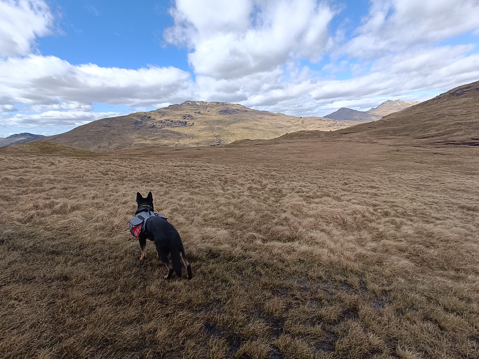
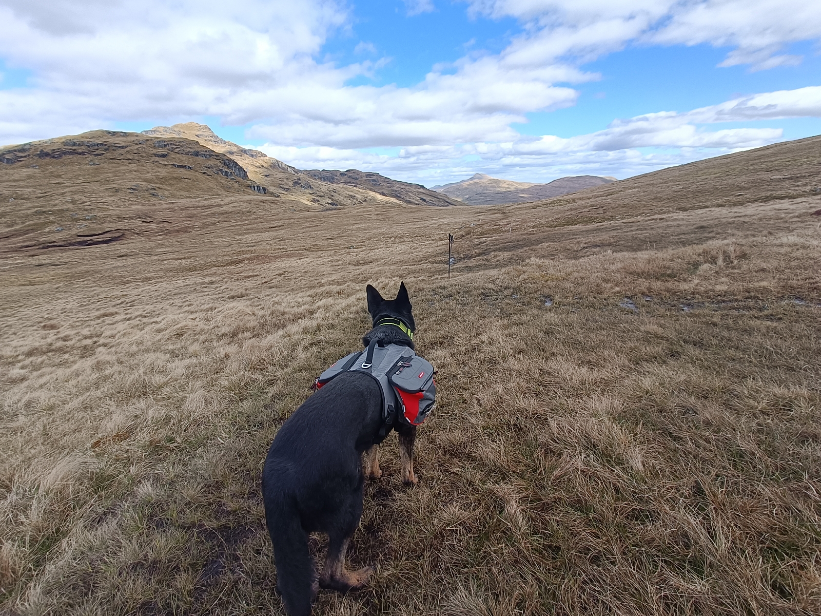
 Volt was carrying his own food, his bowl and a towel (in case he got wet) in his dog panniers. I bought these a while ago but this was the first time he'd worn them. He didn't seem phased at all as we hiked up the forest road that leads to a high bealach between Coilessan Glen and Lochgoilhead.